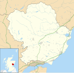
Cortachy Castle
| Cortachy Castle | |
|---|---|
| Cortachy, Angus, Scotland UK grid reference NO398595 | |
 Cortachy Castle | |
| Coordinates | 56°43′24″N 2°59′07″W / 56.723272°N 2.985296°W |
| Grid reference | grid reference NO398595 |
| Type | Mansion |
| Site information | |
| Open to the public | Private |
| Site history | |
| Built | 15th century rebuilt 17th and 19th century |
| Materials | Stone |
Cortachy Castle is a castellated mansion House at Cortachy, Angus, Scotland, some four miles north of Kirriemuir. The present building dates from the 15th century, preceded by an earlier structure that was owned by the Earls of Strathearn. It was acquired by the Ogilvies in 1473 and substantively modified in the 17th and 19th centuries.[1] The 1696 remodelling was done by Tobias Bauchop of Alloa.[2]
In 1820 it was "romanticised", as was the fashion of the day, by the addition of crenellations, plus other alterations by R & R Dickson.[3] Part of the building was damaged by fire in 1883 and it was extensively rebuilt in the following two years[1] by Kinnear & Peddie.[4]
Cortachy Castle is a Category B listed building[5] and the grounds are included in the Inventory of Gardens and Designed Landscapes in Scotland.[6]
The castle is said to be haunted by the spirit of a drummer.[7]
References[edit]
- ^ a b "Cortachy Castle", Royal Commission on the Ancient and Historical Monuments of Scotland: Canmore database, retrieved 7 October 2010
- ^ Alloa Advertiser (newspaper) 25 August 2021
- ^ Dictionary of Scottish Architects: Dickson
- ^ Dictionary of Scottish Architects: Kinnear
- ^ Historic Environment Scotland. "Cortachy Castle (Category B Listed Building) (LB4831)". Retrieved 21 March 2019.
- ^ Historic Environment Scotland. "Cortachy Castle (GDL00108)". Retrieved 21 March 2019.
- ^ "£4m estates sale ends 700-year link Aristocratic Scot puts grouse moor on the market". HeraldScotland. Retrieved 11 February 2018.

